Industry Solution

Infrastructure

Overview

The UK's national infrastructure – from rail networks and utilities to communication systems and roads – requires continuous monitoring and maintenance to ensure safety and operational efficiency. Traditional inspection methods often involve significant risks, operational disruption and substantial costs. Vantage UAV's advanced drone technology provides the solution. Our services deliver speed and efficiency for detailed asset inspections while eliminating access challenges and reducing risk.

Common Use Cases

Asset Inspection

High-resolution imagery and thermal analysis identify structural defects, wear patterns and maintenance priorities across all infrastructure types.

Infrastructure Mapping

Photogrammetry and LiDAR outputs can be used to create accurate 3D models and orthomosaics of entire networks for comprehensive project planning, design verification and asset management.

Safety and Compliance Monitoring

Vantage UAV’s detailed assessments support regulatory compliance while eliminating personnel risk from dangerous manual inspections in challenging or hazardous environments.

Development

Our drone services support development projects from initial ground assessments and ongoing construction monitoring through to completion checks for insurance and handover requirements.

Mast Inspections

Comprehensive mobile phone mast surveys utilise high-resolution 4K cameras and thermal imaging payloads to assess antenna condition, structural integrity and equipment housing without dangerous tower climbs or service interruption. Advanced zoom capabilities capture detailed imagery of antenna arrays, feed lines and mounting hardware to identify corrosion, loose connections and structural wear.

Thermal analysis detects overheating components, electrical faults and insulation failures impacting signal transmission quality. By combining photogrammetry and LiDAR datasets we can create precise 3D models of mast structures, enabling accurate measurements of antenna positioning, structural deflection and compliance with regulatory height restrictions.

Telecommunication Line Inspections

Overhead telecommunication line monitoring combines visual inspection with sensor technology to assess fiber-optic cables, copper networks and supporting infrastructure, with corridor mapping covering around 10km to 15km a day. High-resolution cameras identify cable sag, damaged insulators and vegetation encroachment impacting service reliability.

Thermal imaging reveals electrical hotspots in junction boxes and equipment cabinets, indicating potential failure points before service interruption. Microwave link assessments utilise precision positioning to verify dish alignment and identify structural issues affecting signal transmission.

Facility Surveys

Data centre and telecommunication facility assessments provide full condition reports of critical infrastructure housing. Thermal imaging surveys identify cooling system inefficiencies, electrical distribution problems and equipment overheating impacting operational reliability.

Roof surveys assess structural integrity, drainage systems and equipment mounting points for cellular installations, while specialised caged drones capture detailed imagery of server rooms, equipment racks and cable management systems in confined spaces.

Infrastructure Planning

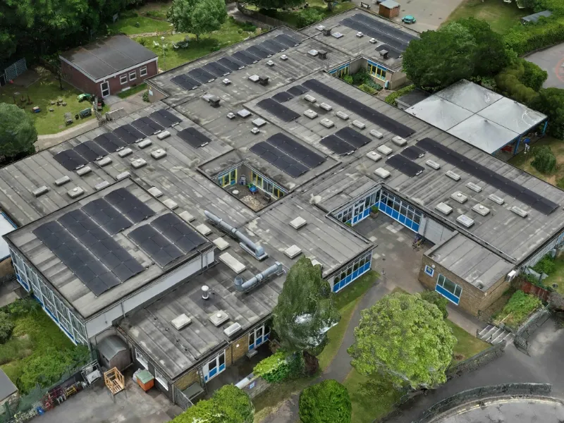
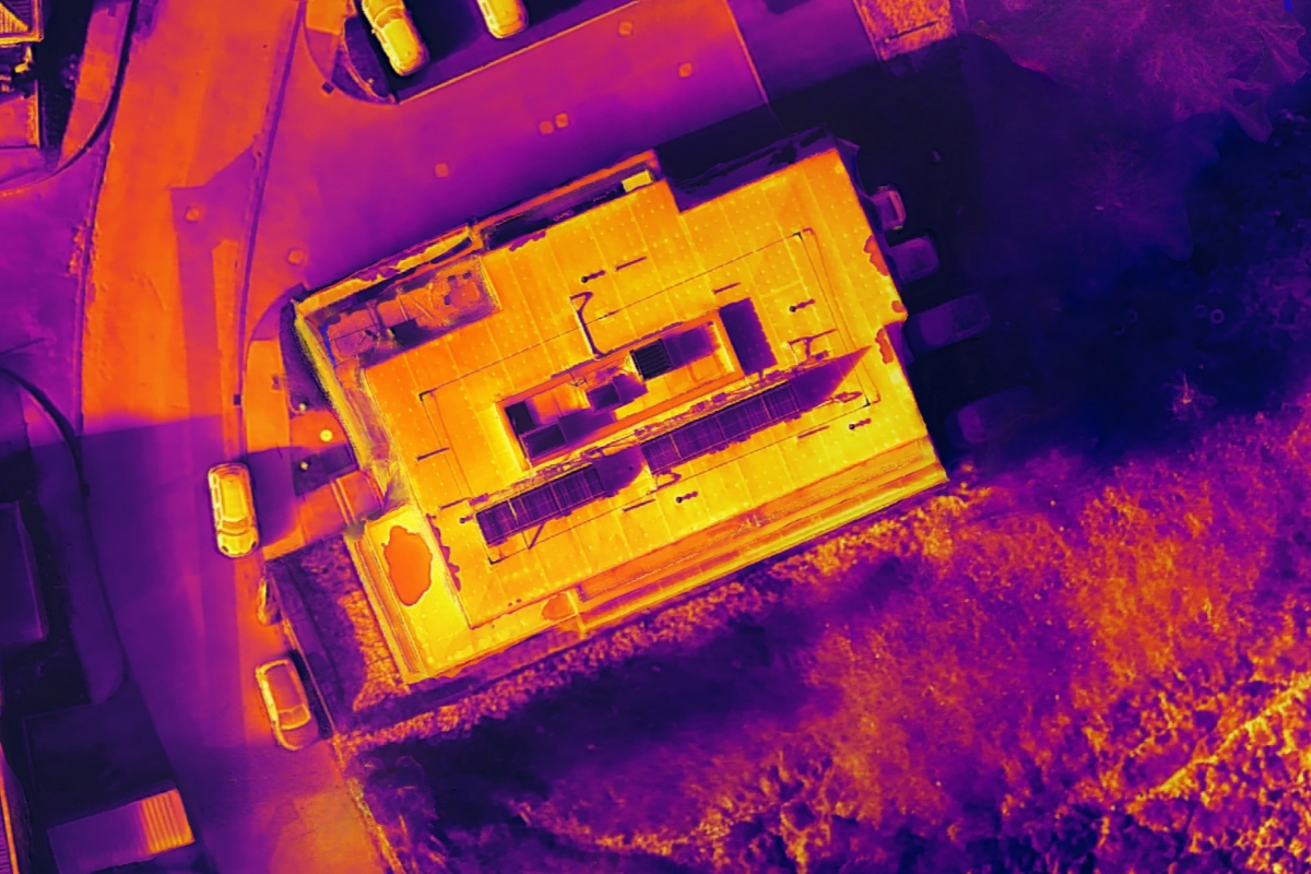
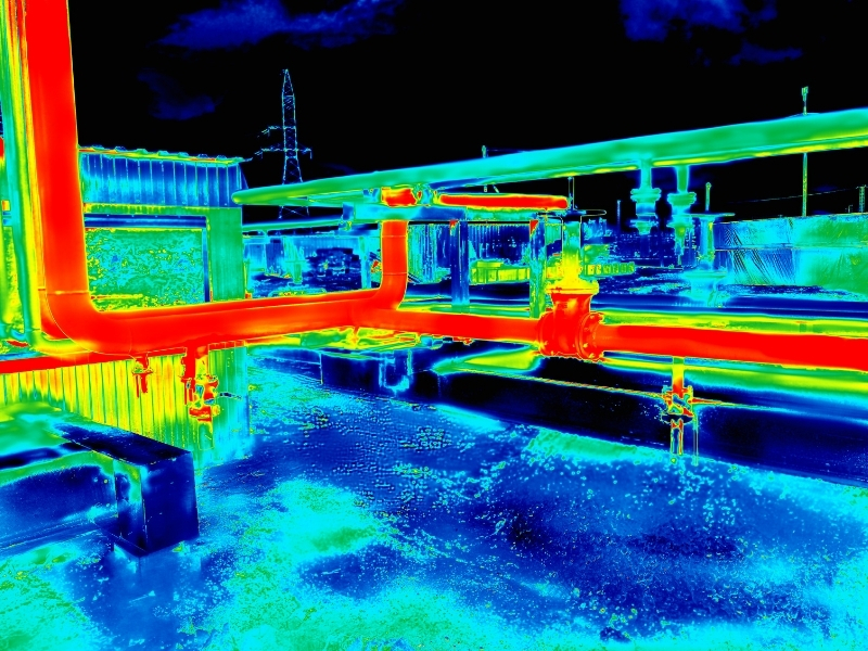
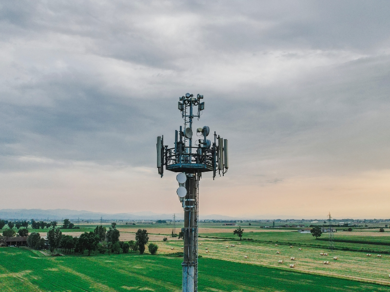
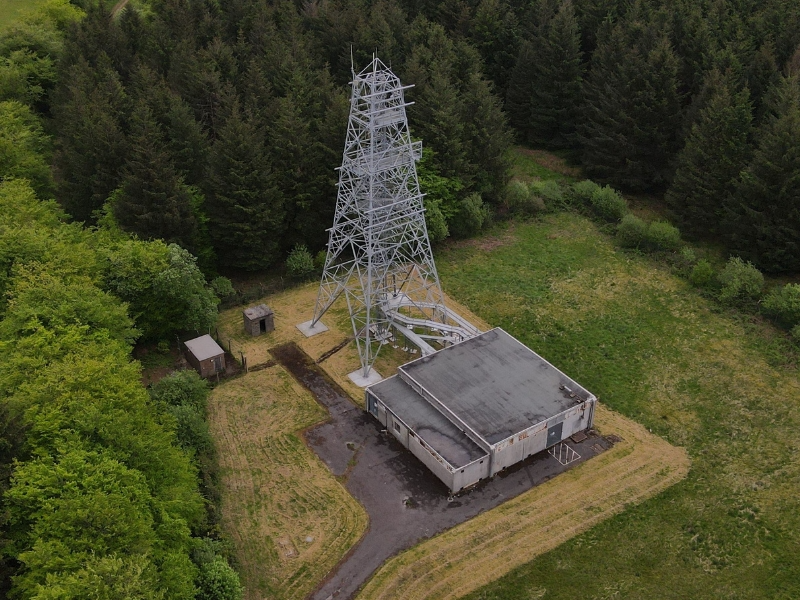
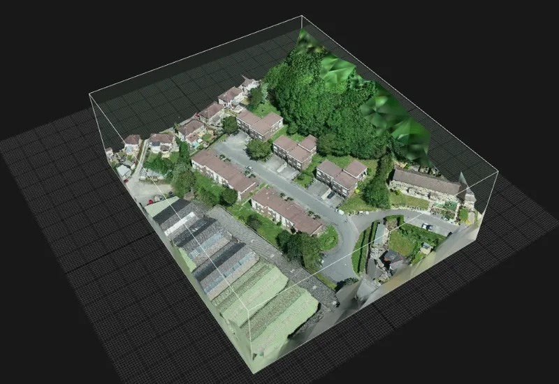
5G network rollout and infrastructure expansion require detailed site surveys and environmental assessments. Photogrammetry and LiDAR data create accurate 3D models of potential installation sites, measuring building heights, structural capacity and radio frequency propagation characteristics.

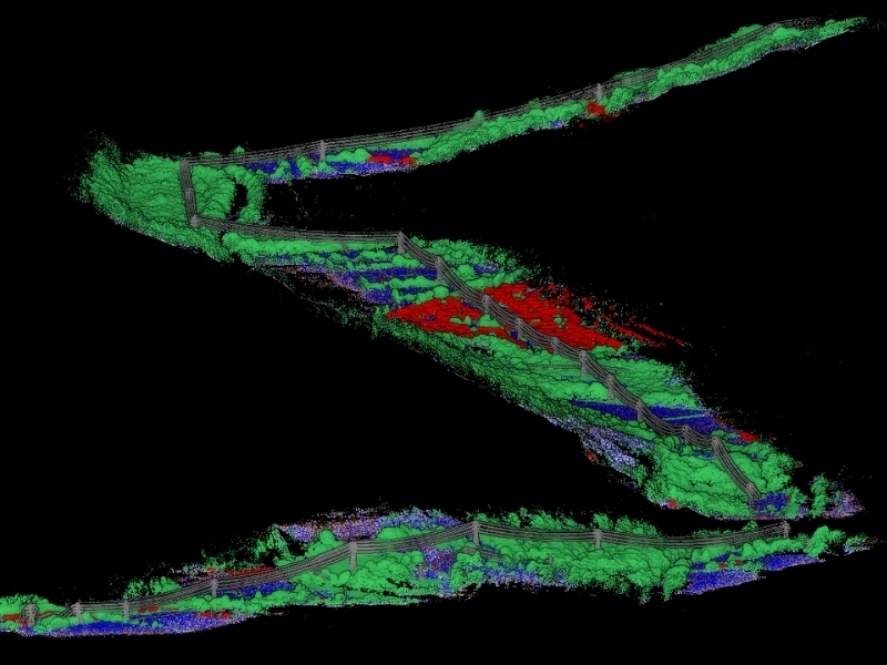
Coverage analysis combines aerial survey data with signal modelling to optimise antenna placement and network performance. Orthomosaics support environmental impact assessments documenting existing conditions and identifying potential conflicts with protected areas. Digital twin technology integrates survey data with network planning tools, enabling virtual testing of proposed installations before physical deployment.

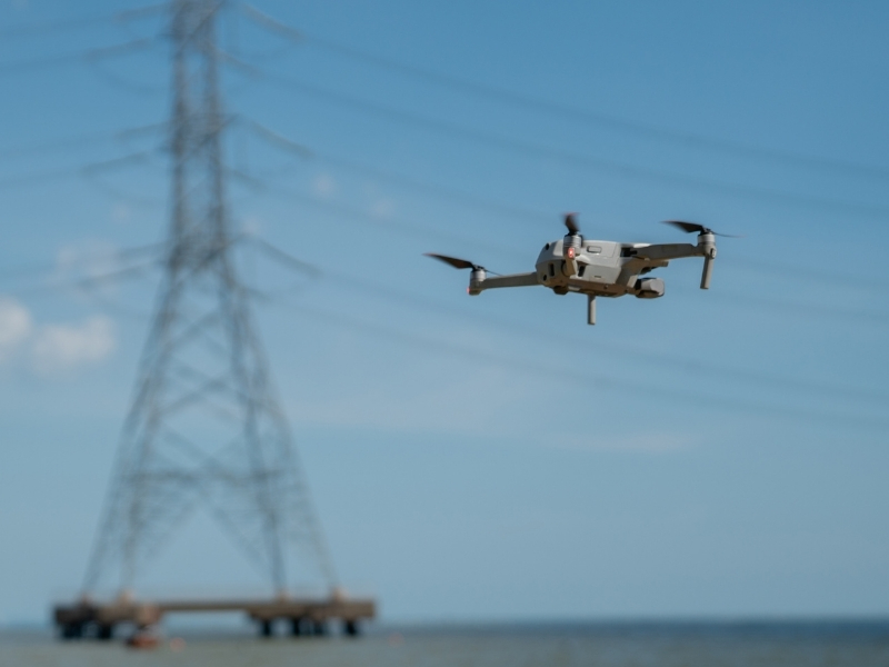
HHLA Sky’s drone control centre enables multiple aircraft to perform different tasks simultaneously, including site surveys, security monitoring and 3D modelling for network planning. This system also enables extended BVLOS (Beyond Visual Line of Sight) flights with appropriate permissions, significantly expanding survey capabilities across extensive communication networks.

Communication

Reliable UK connectivity depends on secure, well-maintained communication infrastructure. Vantage UAV provides comprehensive assessments without service interruption, delivering highly precise data using state-of-the-art sensor technology.

Mast Inspections

Comprehensive mobile phone mast surveys utilise high-resolution 4K cameras and thermal imaging payloads to assess antenna condition, structural integrity and equipment housing without dangerous tower climbs or service interruption. Advanced zoom capabilities capture detailed imagery of antenna arrays, feed lines and mounting hardware to identify corrosion, loose connections and structural wear.

Thermal analysis detects overheating components, electrical faults and insulation failures impacting signal transmission quality. By combining photogrammetry and LiDAR datasets we can create precise 3D models of mast structures, enabling accurate measurements of antenna positioning, structural deflection and compliance with regulatory height restrictions.

Telecommunication Line Inspections

Overhead telecommunication line monitoring combines visual inspection with sensor technology to assess fiber-optic cables, copper networks and supporting infrastructure, with corridor mapping covering around 10km to 15km a day. High-resolution cameras identify cable sag, damaged insulators and vegetation encroachment impacting service reliability.

Thermal imaging reveals electrical hotspots in junction boxes and equipment cabinets, indicating potential failure points before service interruption. Microwave link assessments utilise precision positioning to verify dish alignment and identify structural issues affecting signal transmission.

Facility Surveys

Data centre and telecommunication facility assessments provide full condition reports of critical infrastructure housing. Thermal imaging surveys identify cooling system inefficiencies, electrical distribution problems and equipment overheating impacting operational reliability.

Roof surveys assess structural integrity, drainage systems and equipment mounting points for cellular installations, while specialised caged drones capture detailed imagery of server rooms, equipment racks and cable management systems in confined spaces.

Communication

Reliable UK connectivity depends on secure, well-maintained communication infrastructure. Vantage UAV provides comprehensive assessments without service interruption, delivering highly precise data using state-of-the-art sensor technology.
Select Section
Mast Inspections
Telecommunication Line Inspections
Facility Surveys
Infrastructure Planning

Mast Inspections

Comprehensive mobile phone mast surveys utilise high-resolution 4K cameras and thermal imaging payloads to assess antenna condition, structural integrity and equipment housing without dangerous tower climbs or service interruption. Advanced zoom capabilities capture detailed imagery of antenna arrays, feed lines and mounting hardware to identify corrosion, loose connections and structural wear.

Thermal analysis detects overheating components, electrical faults and insulation failures impacting signal transmission quality. By combining photogrammetry and LiDAR datasets we can create precise 3D models of mast structures, enabling accurate measurements of antenna positioning, structural deflection and compliance with regulatory height restrictions.

Key Benefits

Overcome Hard-to-Reach Inspections
Inspect mobile phone masts, antennas and equipment housing without the need to work at height.
Maintains Continuous Service
Conduct detailed inspections without service interruption or network downtime.
Precise 3D Modelling
Create accurate structural models for analysis, compliance and future modification planning.
Optimise Network Planning
Test area suitability before physical deployment.

Speak with an Expert?

Book a call with us to discuss your requirements and have any questions answered.

Book a call with us to discuss your requirements and have any questions answered.

Grace Hammond
Head of Services - Built Environment

headshot of jon

Jon White
Technical Solutions Manager / Pilot

Our Qualifications

Cyber Essentials

Civil Aviation Authority

ISO 27001

Get in Touch

We're here to answer any questions you may have.