

.jpg)
.jpg)
Yorkshire Housing were advised to undertake a full roof replacement costing c. £350k. Vantage UAV's drone inspection & 3D model revealed only c. £50k of work was required - an 85.7% cost saving!

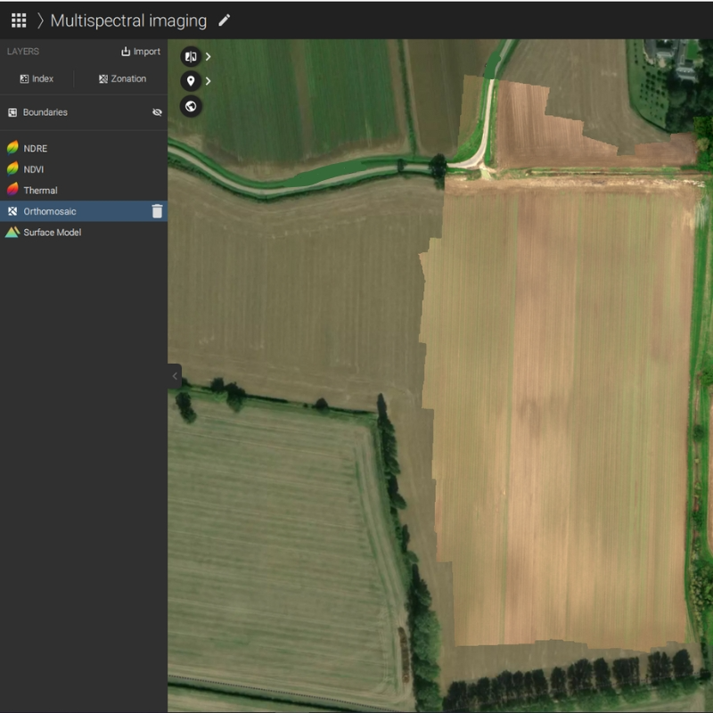
Drone orthomosaics are high-resolution aerial maps created by stitching together multiple overlapping images into a single, geometrically corrected photo through a process called orthorectification. This advanced mapping technique produces accurate, scaled representation of large areas with uniform detail across the entire image.
Unlike traditional aerial photography, orthomosaics eliminate perspective distortion, providing true-to-scale measurements and visualisation, essential for professional surveying, GIS applications, planning and asset management applications.
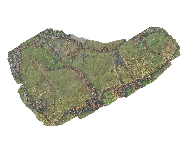
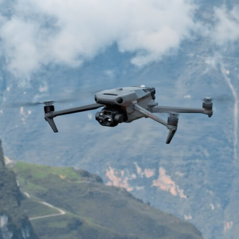
Following systematic flight paths, our drones capture hundreds of overlapping aerial images, ensuring complete coverage with consistent overlap ratios, different camera angles and topographic changes accounted for. Without orthorectification, multiple georeferenced overlapping images will appear distorted, however when corrected, the images will create a single consistent map where perspective, camera tilt and lens distortion effects are all corrected.
To generate 2D orthomosaics, we use a suite of state of the art mapping software. Coupled with rigorous ground control and conventional surveying methods, we deliver to the highest of standards in aerial mapping.
Each orthomosaic undergoes geometric correction to eliminate distortion and ensure uniform scale across the entire image. This process creates true orthographic projection where every pixel represents the same ground area, enabling precise measurements, area calculations and accurate distance assessments directly from the final image.
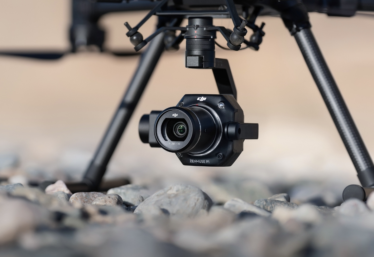
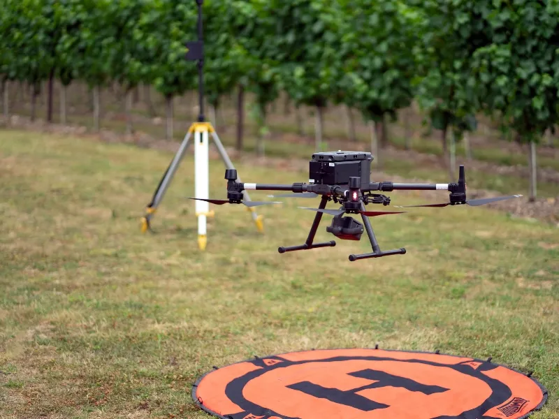
We utilise RealTime Kinematic (RTK) positioning correction in the air so that each image’s position at the time of capture is recorded to within ±1cm, georeferencing each individual image to the highest level of accuracy. We survey in Ground Control Points (GCPs) on the ground to check and correct the remaining positional error as close as ±50mm.
While primarily essential for surveying applications, orthomosaics support diverse requirements across construction progress tracking, agriculture monitoring, infrastructure planning and environmental assessments.
We provide orthoimagery in a range of formats for various industry standard workflows and software, but for those who just need the most accurate birds eye view in their browser or on the go, our online portal allows users to visualise, inspect, annotate and report on their maps on the go!

Here's some quick answers to help you understand our asset inspection capabilities better.
Orthomosaics are geometrically corrected, seamless maps created from hundreds of overlapping images, providing uniform scale and eliminating perspective distortion. Regular aerial photography captures individual images with varying perspectives and scales, making accurate measurements difficult.
Our orthomosaics deliver sub-centimetre ground resolution with measurement accuracy within millimetres, depending on flight altitude and camera specifications. This precision enables survey-grade area calculations and measurements across the entire mapped area.
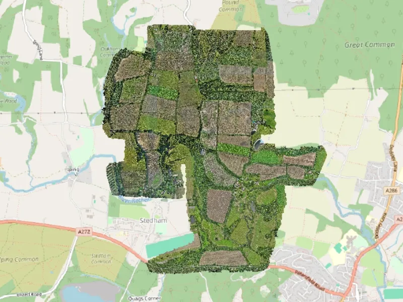
Coverage depends on required resolution and airspace regulations, but single orthomosaics can span from a single property to extensive sites covering hundreds of hectares. Our drone surveys allow large areas to be mapped efficiently while maintaining consistent detail throughout.
Typically orthomosaics are delivered in Georeferenced Tagged Image File Format or .GeoTIFF. This is the most common format for satellite, aerial and drone mapping imagery as they package spatial and imagery data efficiently and without loss of quality or information.
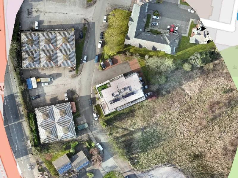
Our orthomosaics are delivered with accuracy reports, metadata and coordinate system definitions (usually EPSG) and can be directly imported into GIS platforms and CAD software. The geo-referenced data ensures accurate positioning within existing mapping systems, enabling seamless integration with your current design and planning workflows.
We're here to answer any questions you may have.

.jpg)