.jpg)
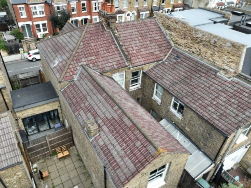
Yorkshire Housing were advised to undertake a full roof replacement costing c. £350k. Vantage UAV's drone inspection & 3D model revealed only c. £50k of work was required - an 85.7% cost saving!

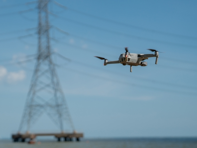
The UK's national infrastructure – from rail networks and utilities to communication systems and roads – requires continuous monitoring and maintenance to ensure safety and operational efficiency. Traditional inspection methods often involve significant risks, operational disruption and substantial costs. Vantage UAV's advanced drone technology provides the solution. Our services deliver speed and efficiency for detailed asset inspections while eliminating access challenges and reducing risk.
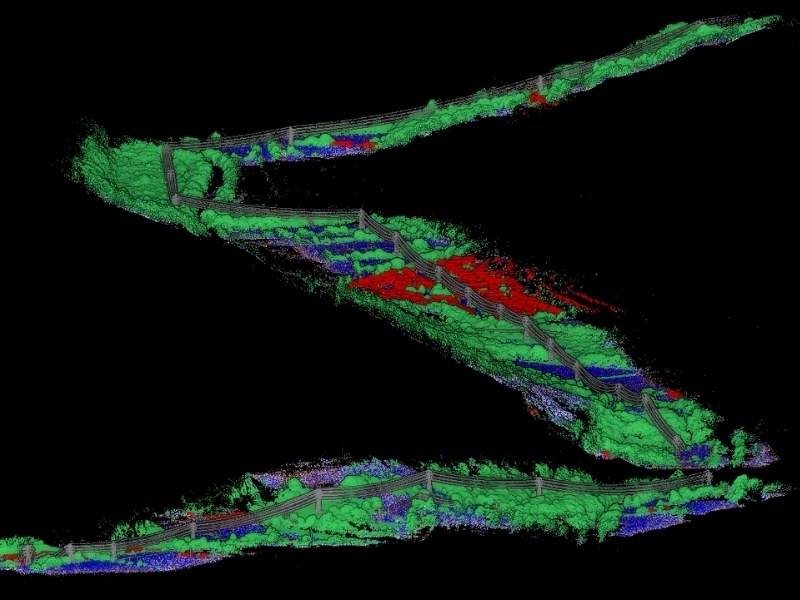

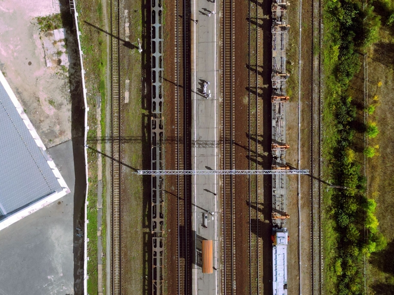
Our high-resolution aerial surveys capture detailed imagery of rail tracks, identifying wear patterns, alignment issues and potential defects without requiring line closures or track possession. LiDAR technology creates detailed 3D point cloud maps and digital twins of tracks and the surrounding environment, delivering a sophisticated asset management tool covering entire railway networks.
Our drone surveys can cover extensive track networks efficiently, completing around 10km to 15km of corridor mapping per day, while maintaining the accuracy for measurements and GPS-referenced issue identification.
This technology surpasses traditional inspection methods, enabling predictive maintenance planning and reducing costly emergency repairs. This long-term asset management strategy increases network efficiency, reduces unplanned service downtime and reduces associated costs.
Regular aerial surveys monitor railway embankments, cuttings and lineside vegetation growth to identify areas requiring clearance before they impact services or create safety hazards. GPS-referenced location data enables maintenance teams to address specific problem areas quickly.
Following severe weather events, we rapidly assess drainage systems and identify blockages, water management problems or areas where track stability may be compromised, allowing operators to make informed decisions about track safety while planning targeted maintenance work.
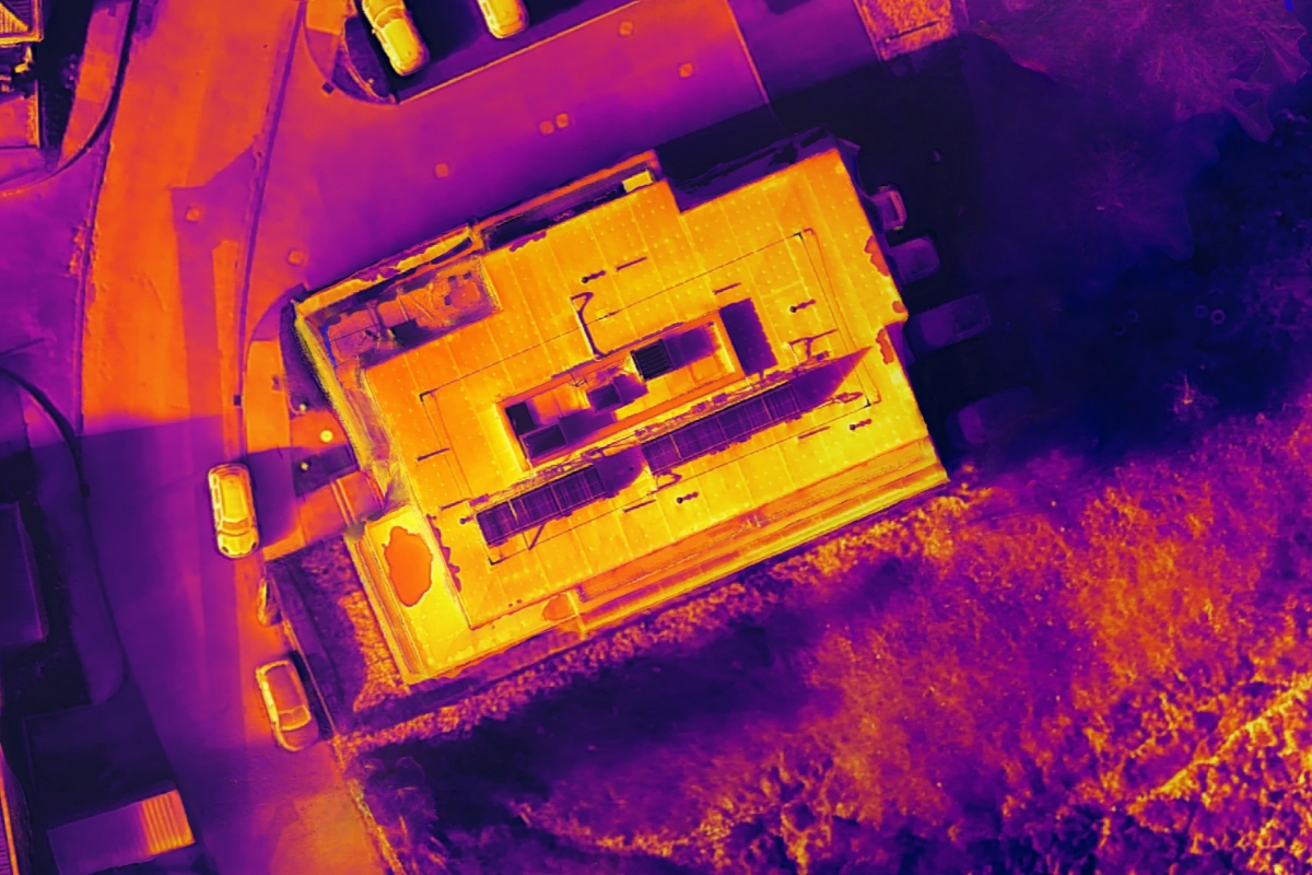
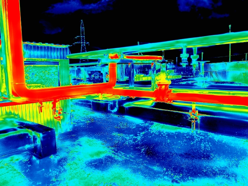
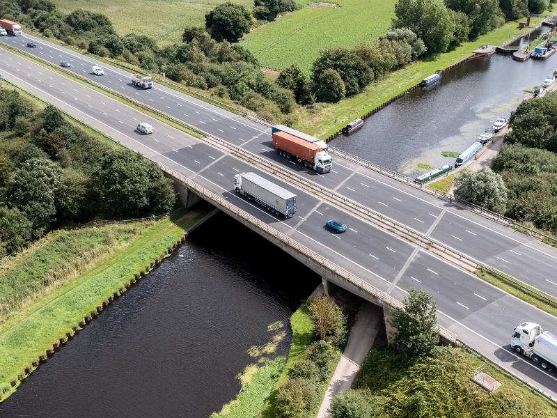
Comprehensive structural assessments of railway bridges, viaducts and elevated sections utilise 4K imagery and thermal analysis to identify structural deterioration, corrosion and maintenance priorities without requiring expensive access equipment or service interruptions. Precise inspection of catenary systems, support structures and electrical infrastructure identifies wear, damage or alignment issues affecting power delivery.
Detect damaged or dropped overhead lines that pose serious risks to passing trains quickly and action rapid response and repair scheduling. Thermal imaging reveals electrical hotspots and insulation failures in overhead line equipment, supporting preventive maintenance programs that reduce the risk of power supply failures and associated service delays.
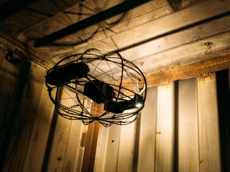
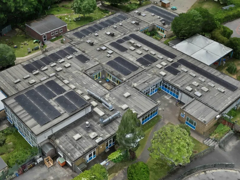
Comprehensive facility surveys cover platforms, canopies, buildings and operational areas to support maintenance planning and regulatory safety compliance. Using our caged drones we collect high-resolution imagery, safely, capturing structural condition, safety hazards and accessibility compliance requirements across station facilities.
Reports generated through our internal asset management platform provide maintenance teams with timestamped images, precise GPS coordinates and detailed inspection notes for efficient work planning, reducing site visits and improving resource allocation.

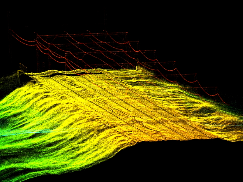
Our high-resolution aerial surveys capture detailed imagery of rail tracks, identifying wear patterns, alignment issues and potential defects without requiring line closures or track possession. LiDAR technology creates detailed 3D point cloud maps and digital twins of tracks and the surrounding environment, delivering a sophisticated asset management tool covering entire railway networks.
Our drone surveys can cover extensive track networks efficiently, completing around 10km to 15km of corridor mapping per day, while maintaining the accuracy for measurements and GPS-referenced issue identification.
This technology surpasses traditional inspection methods, enabling predictive maintenance planning and reducing costly emergency repairs. This long-term asset management strategy increases network efficiency, reduces unplanned service downtime and reduces associated costs.
Regular aerial surveys monitor railway embankments, cuttings and lineside vegetation growth to identify areas requiring clearance before they impact services or create safety hazards. GPS-referenced location data enables maintenance teams to address specific problem areas quickly.
Following severe weather events, we rapidly assess drainage systems and identify blockages, water management problems or areas where track stability may be compromised, allowing operators to make informed decisions about track safety while planning targeted maintenance work.
Comprehensive structural assessments of railway bridges, viaducts and elevated sections utilise 4K imagery and thermal analysis to identify structural deterioration, corrosion and maintenance priorities without requiring expensive access equipment or service interruptions. Precise inspection of catenary systems, support structures and electrical infrastructure identifies wear, damage or alignment issues affecting power delivery.
Detect damaged or dropped overhead lines that pose serious risks to passing trains quickly and action rapid response and repair scheduling. Thermal imaging reveals electrical hotspots and insulation failures in overhead line equipment, supporting preventive maintenance programs that reduce the risk of power supply failures and associated service delays.
Our high-resolution aerial surveys capture detailed imagery of rail tracks, identifying wear patterns, alignment issues and potential defects without requiring line closures or track possession. LiDAR technology creates detailed 3D point cloud maps and digital twins of tracks and the surrounding environment, delivering a sophisticated asset management tool covering entire railway networks.
Our drone surveys can cover extensive track networks efficiently, completing around 10km to 15km of corridor mapping per day, while maintaining the accuracy for measurements and GPS-referenced issue identification.
This technology surpasses traditional inspection methods, enabling predictive maintenance planning and reducing costly emergency repairs. This long-term asset management strategy increases network efficiency, reduces unplanned service downtime and reduces associated costs.


We're here to answer any questions you may have.