Explore Industry Solutions
View Our Drones & Technology
High-resolution 2D RGB drone imagery captures detailed visual data from previously inaccessible vantage points. Our drones reach challenging locations safely and cost-effectively, delivering crisp, accurate images that reveal structural details, defects, and conditions difficult to assess from ground level or traditional inspection methods.
Our drones capture GPS-referenced, time-stamped, close-up imagery of specific assets and problem areas. This detailed imagery provides intricate surface detail and anomalies that would be hard to detect from a distance.
Wide-angle coverage provides complete site context through a comprehensive birds-eye view perspective, impossible to achieve from ground level. These high-quality shots excel at capturing extensive structures and areas efficiently whilst maintaining safety standards.
Turn visual data into actionable insights. All still imagery collected integrates seamlessly into our secure asset management portal, where images can be annotated and categorised. Digital measurement capabilities can be provided as an additional feature when required through access to a further platform.
Add notes, highlight defects and generate shareable reports. The GPS-referenced images link directly to asset locations, creating a comprehensive visual database, remotely accessible to your entire team.
Here's some quick answers to help you understand our asset inspections better.
Drone inspection times vary depending on the asset size and data requirements. However, compared to traditional inspection methods, drone surveys are drastically faster - reducing inspection times from days/weeks to hours while delivering more sophisticated digital reports.
GPS accuracy is usually around ±0.5m horizontally and ±1.5m vertically, though it varies in real time when flying.
We prioritise data protection through a comprehensive privacy protocol. All residents or stakeholders receive notification letters one week before scheduled flights, and our post-inspection process includes face-blurring technology and data redaction of any sensitive information. All processed data is stored in our secure portal, accessible only to authorised personnel, ensuring both privacy compliance and inspection quality.
Measurement accuracy works to a Mean Absolute Error of 1.21 metres, often outperforming traditional methods, ensuring your team receives dimensional data for accurate project specifications and planning.
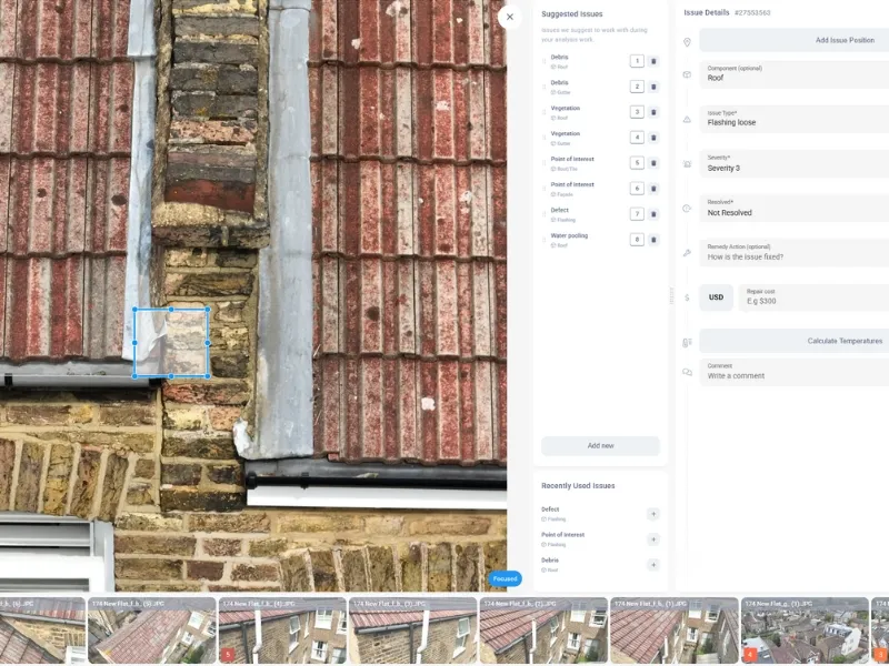
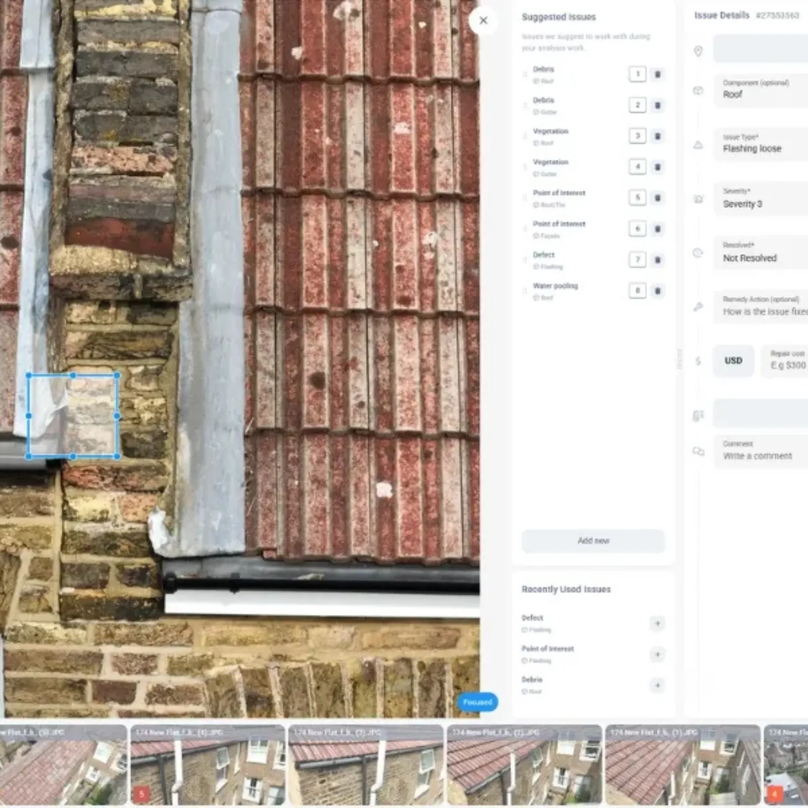
We strive to get the data we collect back to you as soon as we can. Timescales depend on the size and complexity of the project. Our process includes collecting the still imagery data, taking it through a quality control stage to remove any identifying factors, and then uploading or sending the final output via your preferred data delivery method. We take data security and confidentiality seriously. All data handled follows strict data protection protocols, and any transfers are carried out using secure, encrypted channels.
For small-scale projects, we aim to return the data within a week. For larger-scale projects, delivery may take several weeks. If preferred, we can provide data in a staggered delivery format as it's processed.
We're here to answer any questions you may have.