Overview

We combine state-of-the-art drones, payloads, sensors and data visualisation tools to maximise your data capture and ensure seamless integration with your existing systems.  

Explore our technology below.  

These are our core capabilities, not our limits - bring us your challenge and we'll deliver the right solution.

Explore by Technology Type

Data Visualisation Tools

Our comprehensive suite of data visualisation solutions transforms raw aerial data into actionable insights, tailored to your specific data types and operational needs.

All solutions integrate seamlessly with your existing systems, ensuring your drone data enhances rather than disrupts your current workflows.

LiDAR Data Visualisation

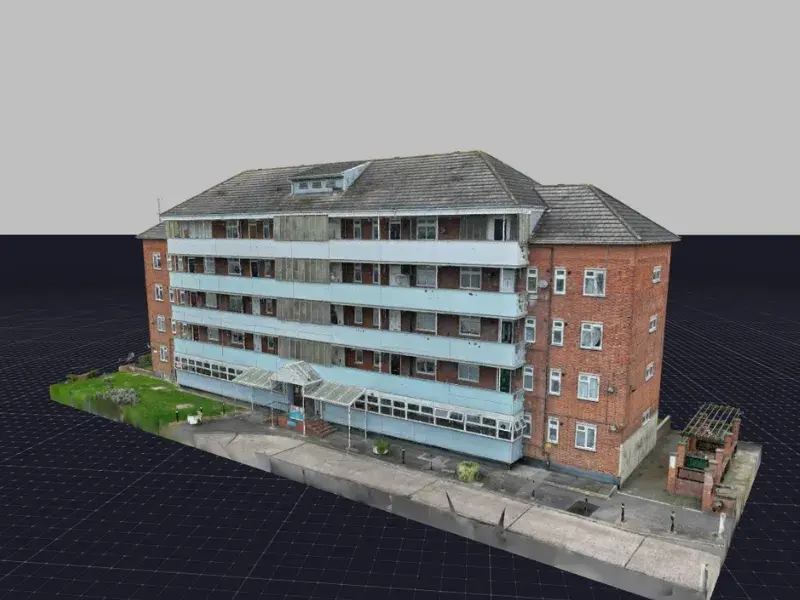
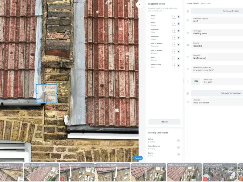
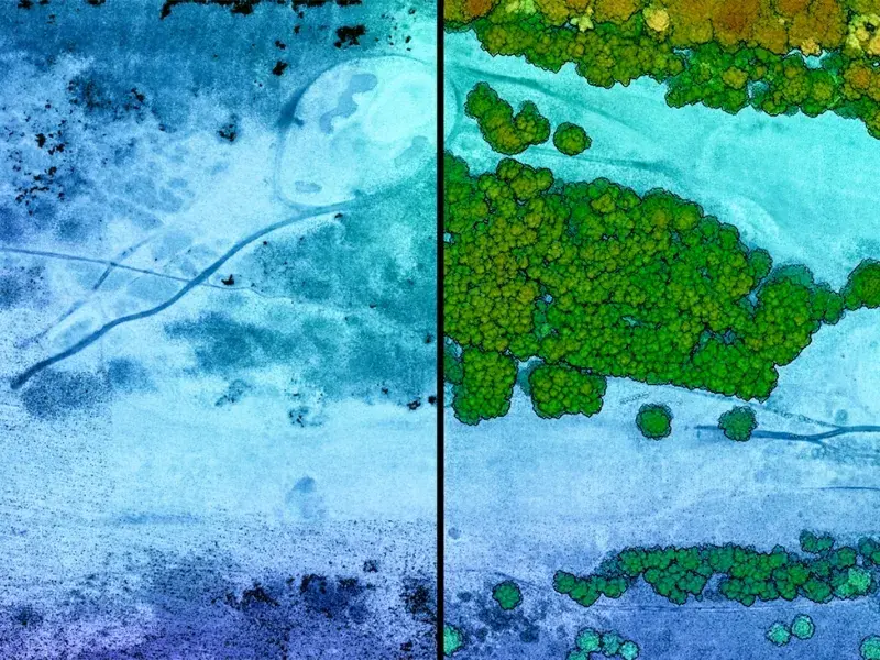
Advanced point cloud processing and analysis tools enable terrain modelling, vegetation classification, volumetric calculations and terrain change detection. Delivers survey-grade outputs for engineering and planning applications.

Speak with an Expert?

Book a call with us to discuss your requirements and have any questions answered.

Kieren Milne

Operations Coordinator

Get in Touch

We're here to answer any questions you may have.

Our Qualifications

Cyber Essentials

Civil Aviation Authority

ISO 27001