Data Solution

LiDAR

Explore Industry Solutions

View Our Drones & Technology

Overview

LIDAR (Light Detection and Ranging) technology generates precise 3D representations of the world around us. Our drone-based topographic and bathymetric LiDAR solutions deliver millimetre-accurate dimensional data for complex topographic and hydrographic analysis.

Types of Imagery

LiDAR

Topographic LiDAR

LiDAR systems capture millions of precise measurement points per second using a pulsed near-infrared laser, measuring the distance from the scanner to the Earth’s surface. Georeferenced and reprojected from their point of origin, laser scanners produce detailed 3D terrain models with incredible accuracy.

This technology penetrates vegetation and tree canopies, revealing true ground condition, structures and features unreachable by traditional surveying methods. Commonly used to create detailed topographic maps, contour lines, and digital elevation models, LiDAR provides detailed spatial data for volumetric analysis and even biomass calculation in forestry.

Bathymetric (Underwater) LiDAR

Bathymetric LiDAR uses full-waveform green lasers to penetrate water surfaces to map underwater topography and submerged structures. This bleeding-edge technology provides accurate depth measurements, river cross-section analysis, and hydrographic charting capabilities without the requirement for costly diving operations, water drainage or vessel deployment.

Traditionally sediment deposit analysis and underwater asset condition assessments have been a risky undertaking necessitating a human presence in the water. Derisking this situation using drones can be both a time and a life saver.

The depth range depends upon the water clarity, with LiDAR able to reach around double the ultimate depth of visibility through the water.

Point Cloud Analysis

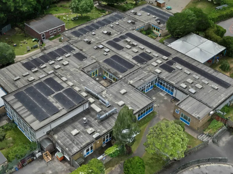
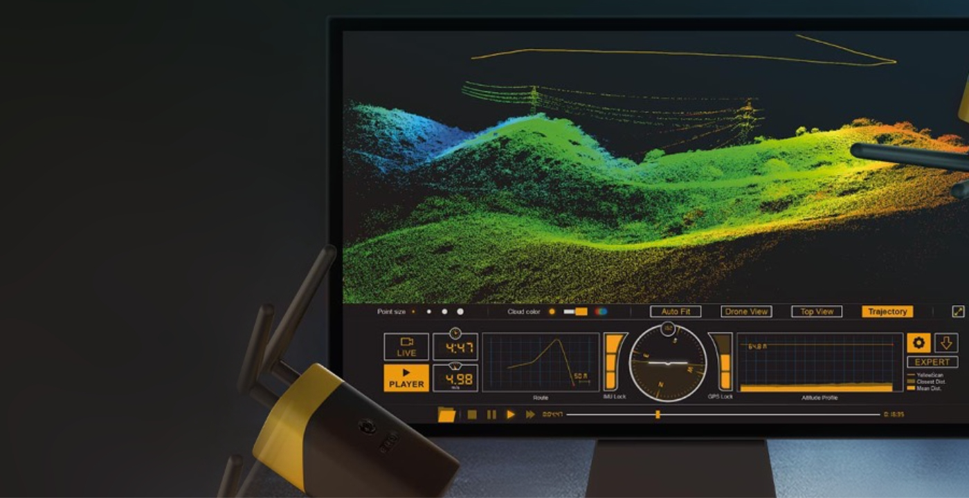
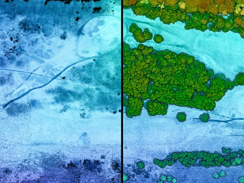
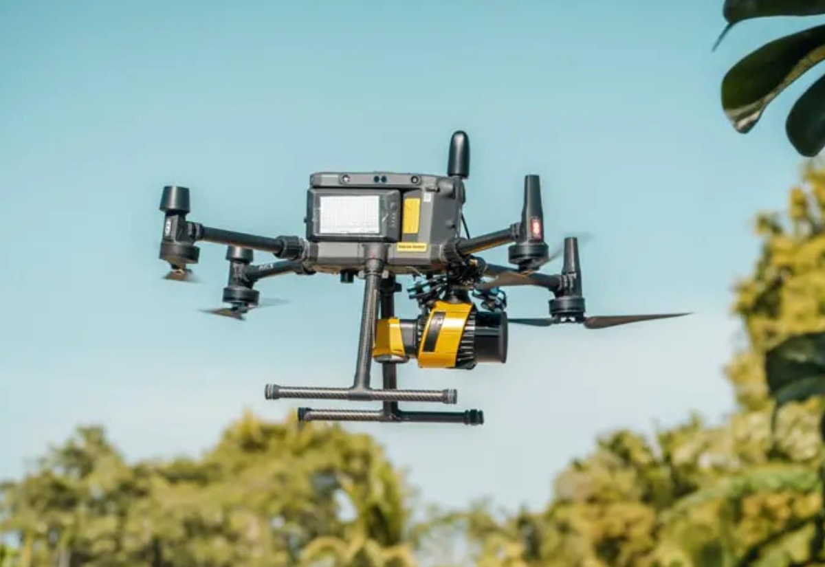
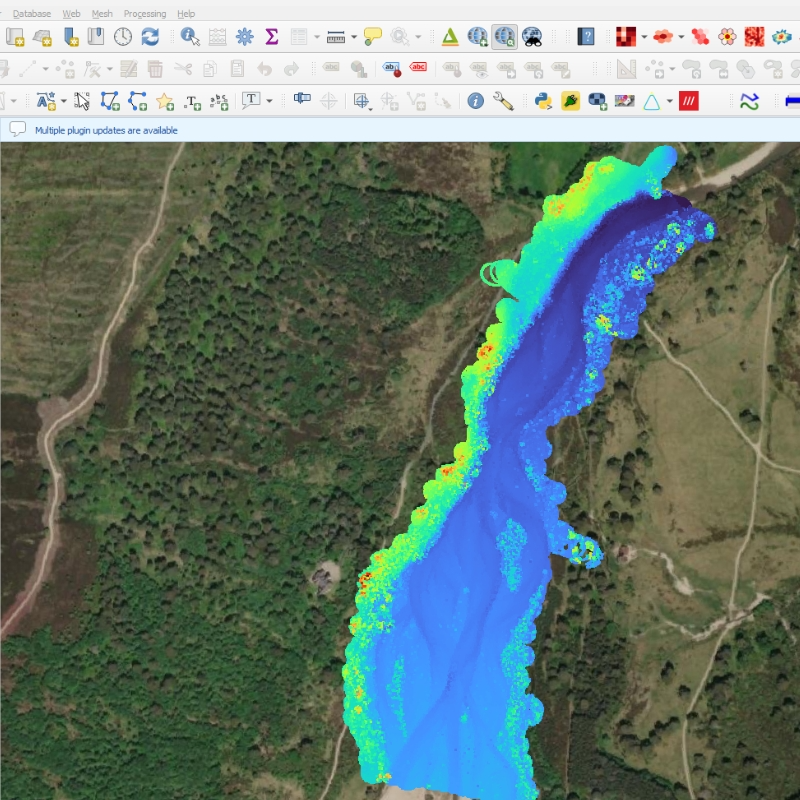
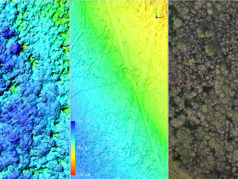
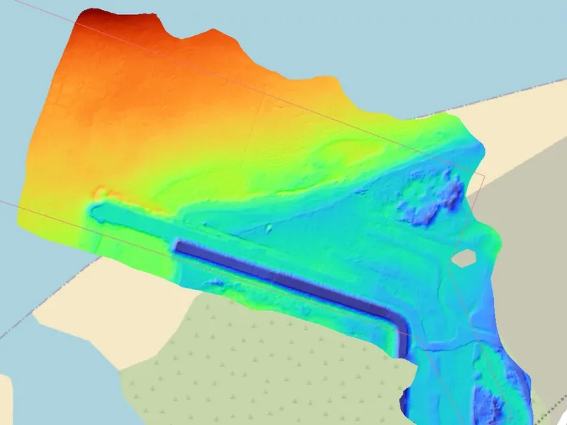
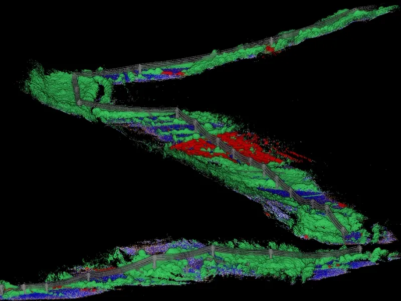
LiDAR data integrates seamlessly into our online analysis and reporting platforms, enabling volumetric calculations, change detection and predictive modelling. Most used for elevation modelling, terrain analysis, flood plain analysis and large-scale structural digitisation, our range of LiDAR solutions have been deployed worldwide supporting infrastructure and environmental projects with precision and accuracy.

Point cloud data can be filtered, classified and measured with engineering-grade precision, supporting engineering design projects, highways and infrastructure monitoring, geomorphology and compliance reporting.

Explore Industry Solutions

Agriculture

Learn More

Construction

Learn More

Maritime

Learn More

Speak with an Expert?

Book a call with us to discuss your requirements and have any questions answered.

Grace Hammond
Head of Services - Built Environment

Solutions in Action

South Lakes - Housing Estate Inspection

Learn More

St Luke's Church - 3D Model

Learn More

School Building Inspection

Learn More

FAQs

Here's some quick answers to help you understand our asset inspections better.

Can LiDAR penetrate vegetation and water simultaneously?

Yes! We have effectively captured subsurface topographic data of river systems underneath forest canopies and heavy tree cover. While dense vegetation makes the task trickier, it can still yield effective and actionable results. However, dense vegetation or murky water can limit penetration effectiveness and data quality.

How large an area can a drone with LiDAR cover in one session?

Topographic LiDAR systems optimised for wide field of view can yield up to 200 hectares of high-quality point cloud data per day of operation. Historically, we have covered 17km of powerline mapping in a day. Bathymetric LiDAR yields a shallower field of view and very different operating procedures; however we can effectively map 2km stretch of shoreline to 500m out to sea in a day.

What software formats do you provide LiDAR data in?

LiDAR data comes in a range of proprietary and industry standard formats. Typically, you can expect .LAS/.LAZ files, ASCII .XYZ files, or even .CSV lists for ease of data ingest to larger integrated data streams. All of these can be easily visualised in free software like CloudCompare or using our online data portal where it can be integrated with GIS data and other geographical contextual media.

What is the accuracy difference between ground and bathymetric LiDAR?

Typically, a UAV LiDAR survey with RTK survey control will deliver an RMSE of ±0.010m in X,Y and Z. With Bathymetric LiDAR, the method of survey yields accuracies of ±0.050m for uncontrolled subsurface points. This can be improved by correcting against vessel-collected echo-sounder data.

How does weather affect LiDAR data collection?

Ground-based LiDAR operates effectively in most weather conditions, though heavy rain can affect accuracy and drone flight. Bathymetric LiDAR can be conducted in anything but rain, but good water clarity is desirable for optimal results. We schedule surveys during appropriate weather windows and will reschedule if unsuitable for flying.

Get in Touch

We're here to answer any questions you may have.

Our Qualifications

Cyber Essentials

Civil Aviation Authority

ISO 27001