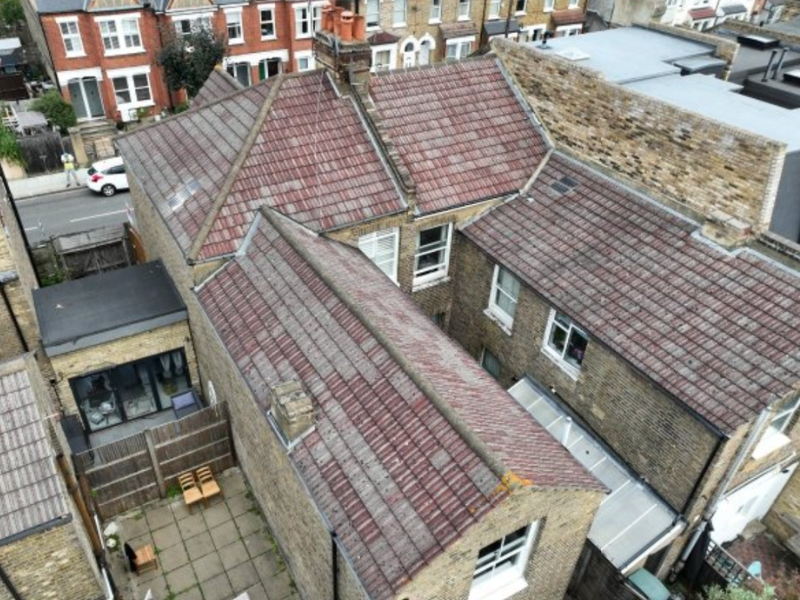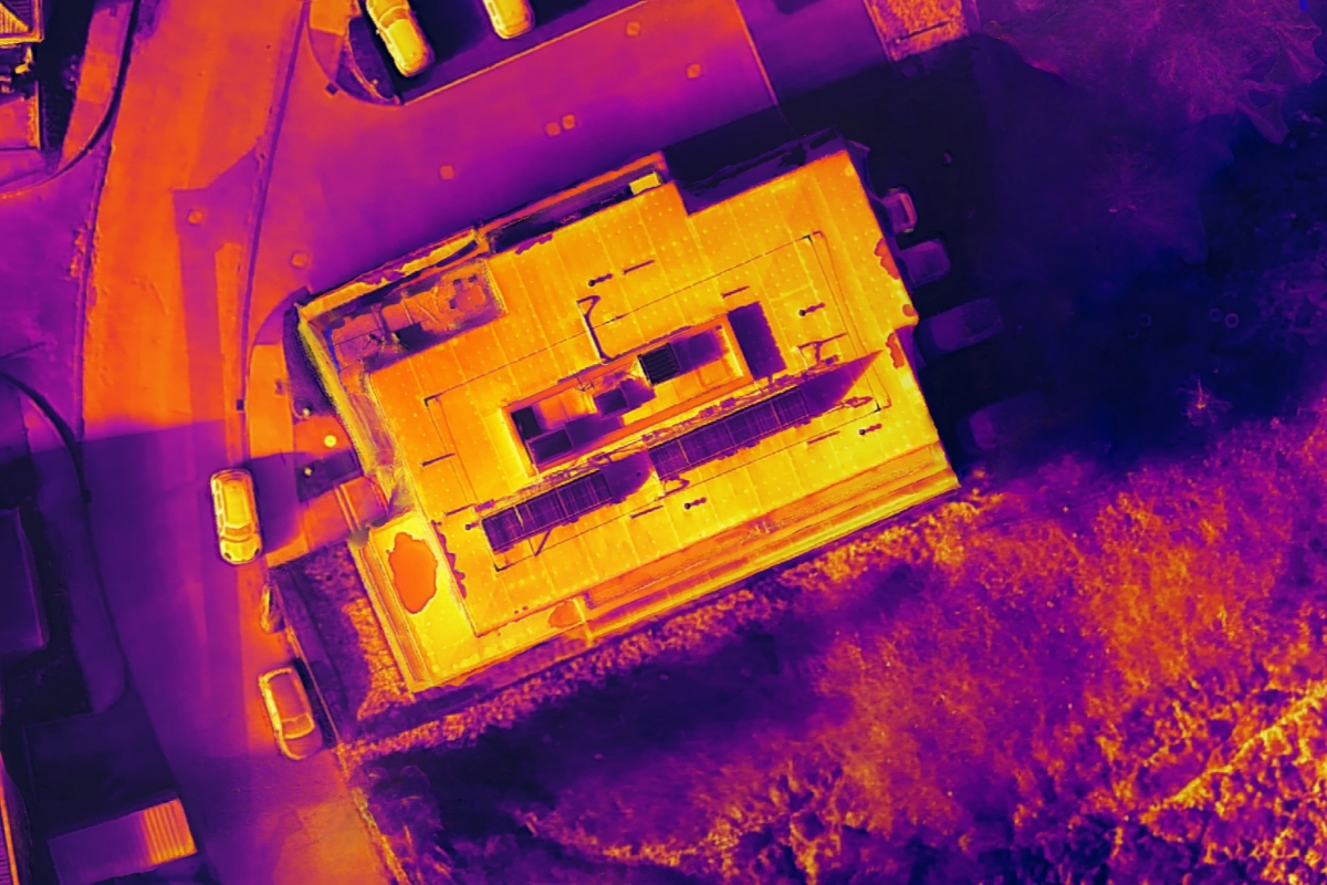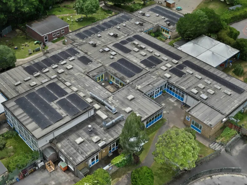
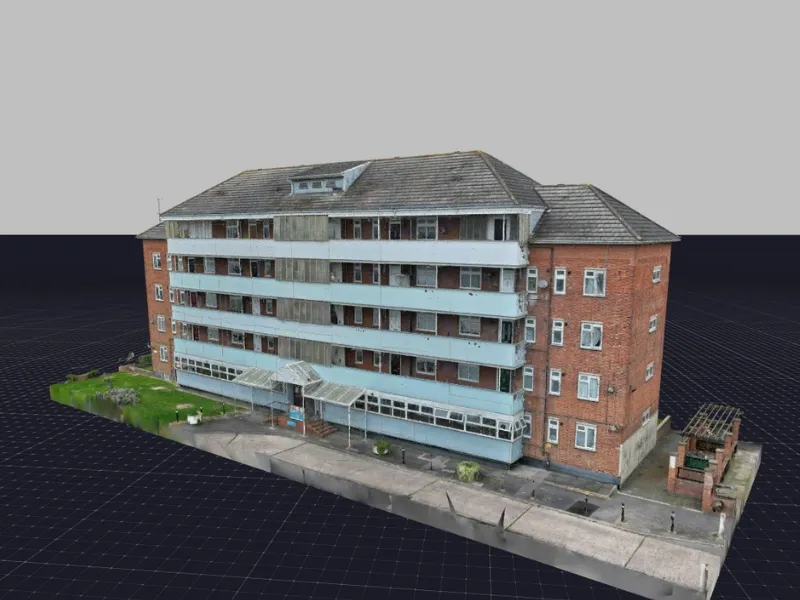
Vantage UAV conducted a comprehensive drone survey of a school building during half-term to assess structural condition and support maintenance planning.
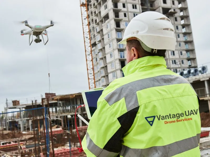
The construction industry is rapidly adopting commercial drones to advance project management and site operations, with Vantage UAV at the forefront of this shift with our advanced drone technology. Our UAV solutions deliver enhanced efficiency, safety and oversight capabilities for:
From daily operational monitoring to comprehensive project tracking and security surveillance, drones provide precise data collection and real-time insights. These actionable outputs streamline workflows with detailed reporting, redefining how construction teams manage projects.
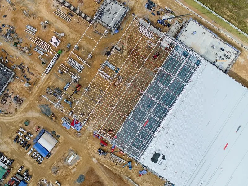

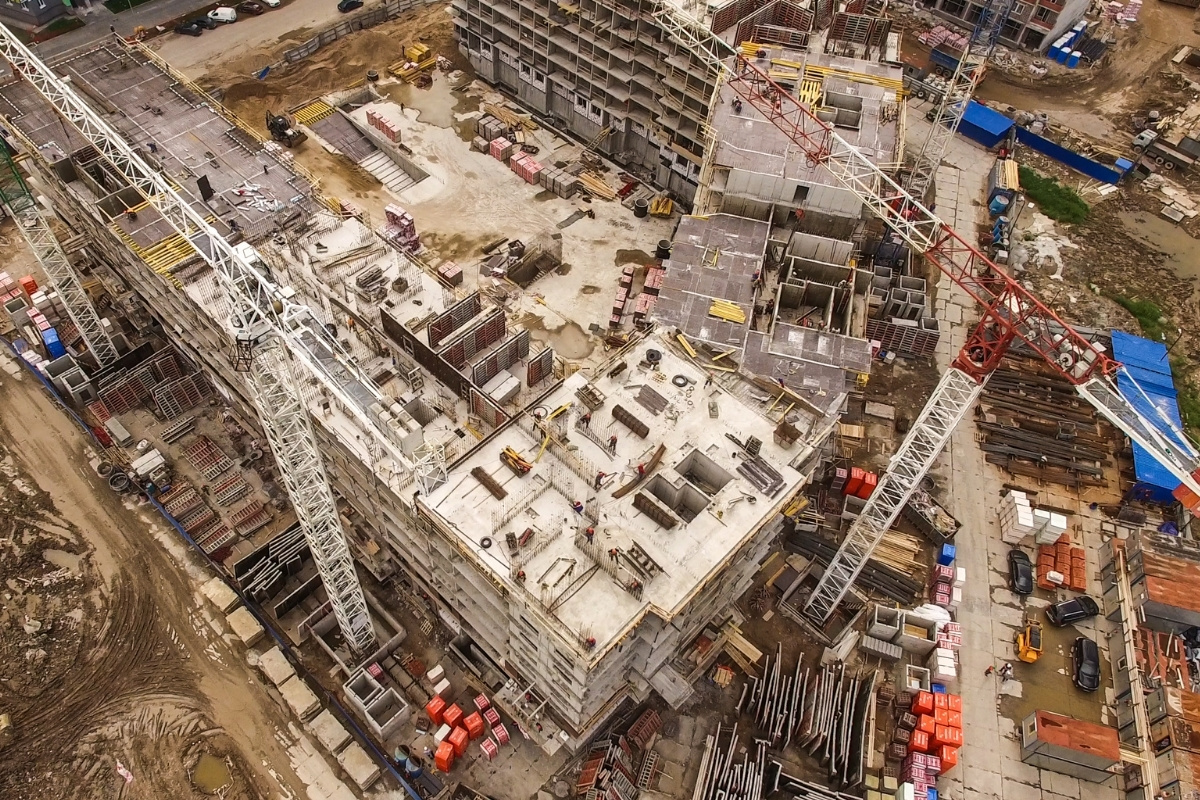
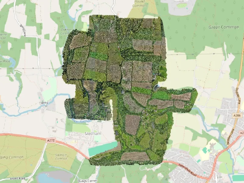
High-resolution orthomosaics provide geometrically accurate, scaled aerial views of entire construction sites. These detailed maps enable precise site planning and design verification, supporting layout planning, boundary identification and spatial analysis.
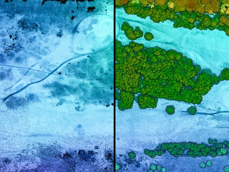
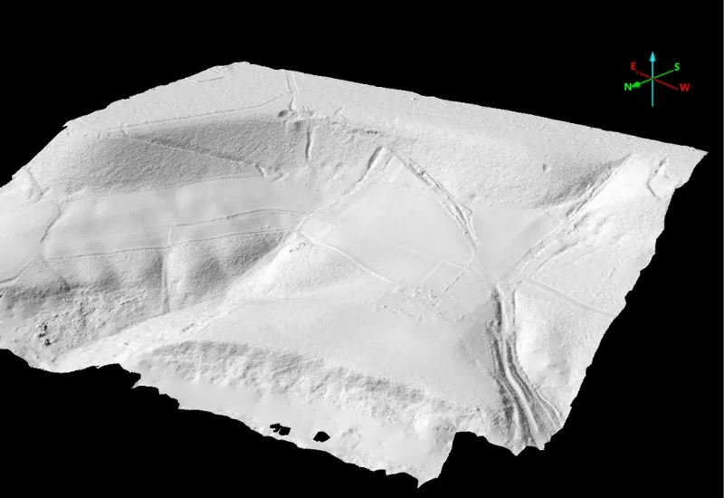
Our advanced LiDAR technology captures precise elevation data and terrain characteristics, creating digital terrain models essential for pre-construction planning. Accurate ground surface analysis supports land levelling calculations, drainage planning and foundational design requirements.
3D digital twin models provide detailed virtual replicas of buildings and structures requiring in-depth analysis. These precise digital models support complex construction planning, structural analysis and design verification.

High-resolution orthomosaics provide geometrically accurate, scaled aerial views of entire construction sites. These detailed maps enable precise site planning and design verification, supporting layout planning, boundary identification and spatial analysis.
Our advanced LiDAR technology captures precise elevation data and terrain characteristics, creating digital terrain models essential for pre-construction planning. Accurate ground surface analysis supports land levelling calculations, drainage planning and foundational design requirements.
3D digital twin models provide detailed virtual replicas of buildings and structures requiring in-depth analysis. These precise digital models support complex construction planning, structural analysis and design verification.
High-resolution orthomosaics provide geometrically accurate, scaled aerial views of entire construction sites. These detailed maps enable precise site planning and design verification, supporting layout planning, boundary identification and spatial analysis.


We're here to answer any questions you may have.

.jpg)