We are proud to announce that we are now the official UK Repair and Maintenance Centre for Autel!
Click to find out more
Click to find out more
There is a well-known saying that a picture paints a thousand words. In property surveys and building condition assessments, that has never been more true. But the question is not just whether you have images. It's whether they are showing you the full picture.
For property managers overseeing portfolios of any size, that distinction matters enormously.
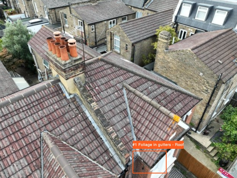
A written condition report can describe a defect. A close-up photograph can document it. But neither can show you where that defect sits in relation to the rest of the building, or what the roof looks like as a whole.
That missing context is the difference between reactive maintenance and genuinely informed asset management.
When a surveyor works from ground level or standard scaffold access, their view is limited by physics. Phrases like "not accessible" or "assumed satisfactory" appear in survey reports so often they start to feel routine. But every one of them is a gap in your knowledge about an asset you are responsible for managing.
A drone survey does not just get you closer to the problem. It changes the angle entirely.
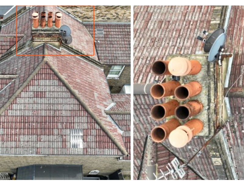
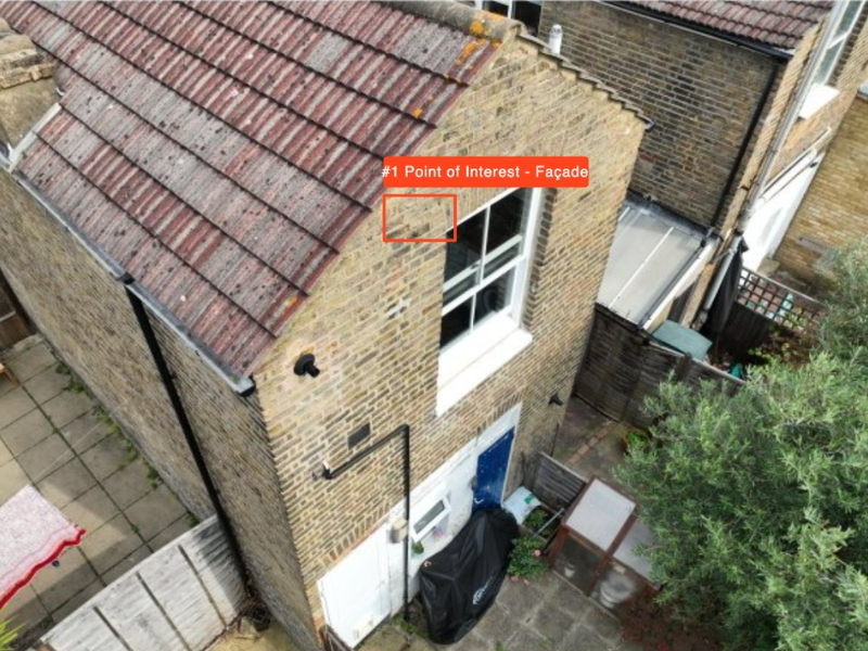
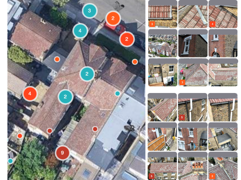
High-resolution aerial imagery captures the full external fabric of a building from every elevation, including parts that have never been properly seen before. Crucially, every image is GPS-located. Each defect is not just photographed but precisely positioned, so when you brief a contractor there is no ambiguity about which section needs attention or what access equipment is required.
A building's external fabric is a system, not a collection of individual components. A blocked gutter leads to water tracking behind the fascia. A failing chimney junction allows water into the roof structure. You can only see how these things connect when you can see the whole building.
Close-up photography shows you the detail without the story. Aerial imagery shows you both.
Managing one property with incomplete condition data is a risk. Managing fifty with it is a liability.
Aerial surveys give portfolio managers a consistent, evidenced baseline across every asset. That baseline changes how you plan. Instead of budgeting reactively, you can prioritise works across your portfolio based on verified visual evidence and know what needs attention now, what can wait and what you are simply monitoring.
Traditional surveys have their place. But aerial imagery changes the frame. It gives you full external context, GPS-located evidence, visibility of elements that ground-level inspection routinely miss and a consistent baseline for ongoing condition monitoring.
A picture paints a thousand words. But only if it is showing you the full picture.


