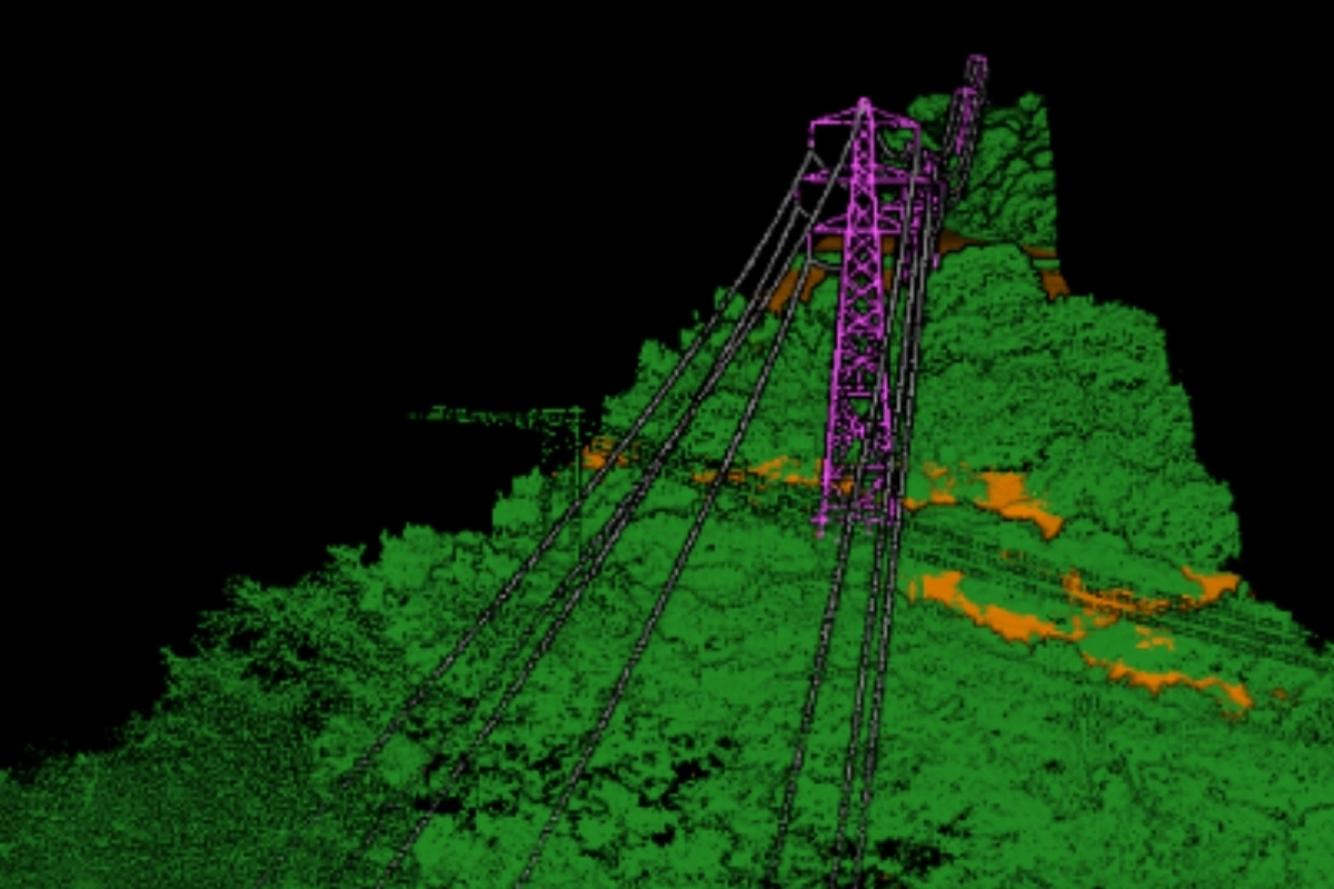
LiDAR Surveying
LiDAR (Light Detection and Ranging) is a type of advanced technology that is used to measure the distance of objects from a given point. It uses laser light pulses to map out the three-dimensional surface of the Earth, producing highly accurate data that can be used for various applications, such as surveying land, providing detailed topographical maps of large areas, and creating 3D models of landscapes and structures. The technology is used in a variety of industries, including construction, engineering, and transportation, as well as in the energy sector. It has become increasingly popular due to its accuracy, ease of use, and cost-effectiveness.
LiDAR surveying offers several advantages over traditional surveying techniques, such as its overall accuracy and versatility. It is particularly useful in areas that are difficult to access or are prone to vegetation growth as it can be used to obtain highly accurate data without the need for a physical surveyor or manual measurements. It can be used to inspect roads and railway tracks, monitor the progress of construction sites, calculate surface/volume of mine operations and survey powerlines.